The Amazon is the world’s largest river by volume of water. Flowing from the Andes to the Atlantic Ocean, its river basin covers nearly 40% of South America. The Amazon River carries more water than the next seven largest rivers combined, contributing 20% of the world’s freshwater river discharge to sea.
The middle-lower Amazon spans from the confluence with the Negro River to the confluence with the Tapajós River. Along this reach, large and complex floodplains lie on both sides of the river.
Code
import folium# Set heightf = folium.Figure(height=300)# Default OpenStreetMap basemapm = folium.Map(location=[-2.7, -57], zoom_start=7, control_scale=True).add_to(f)# Esri Satellite basemapesri_tile = folium.TileLayer( tiles='https://server.arcgisonline.com/ArcGIS/rest/services/World_Imagery/MapServer/tile/{z}/{y}/{x}', attr='Esri', name='Esri Satellite', # This name will appear in the layer control overlay=False, control=True).add_to(m)# Toggle between layersfolium.LayerControl().add_to(m)m
Figure 1: Middle-Lower Amazon River
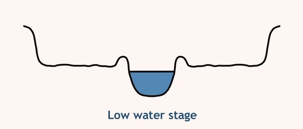
The Amazon’s water level fluctuates seasonally by as much as 10 meters. During the low-water stage, water flows within the main channel. As the water level rises, it overflows the riverbanks, carrying sediments that are deposited as the water loses energy.
This flooding can last up to seven months each year. Over time, these sediment deposits accumulate, forming extensive floodplains. Within these floodplains, there are large water bodies known as floodplain lakes.