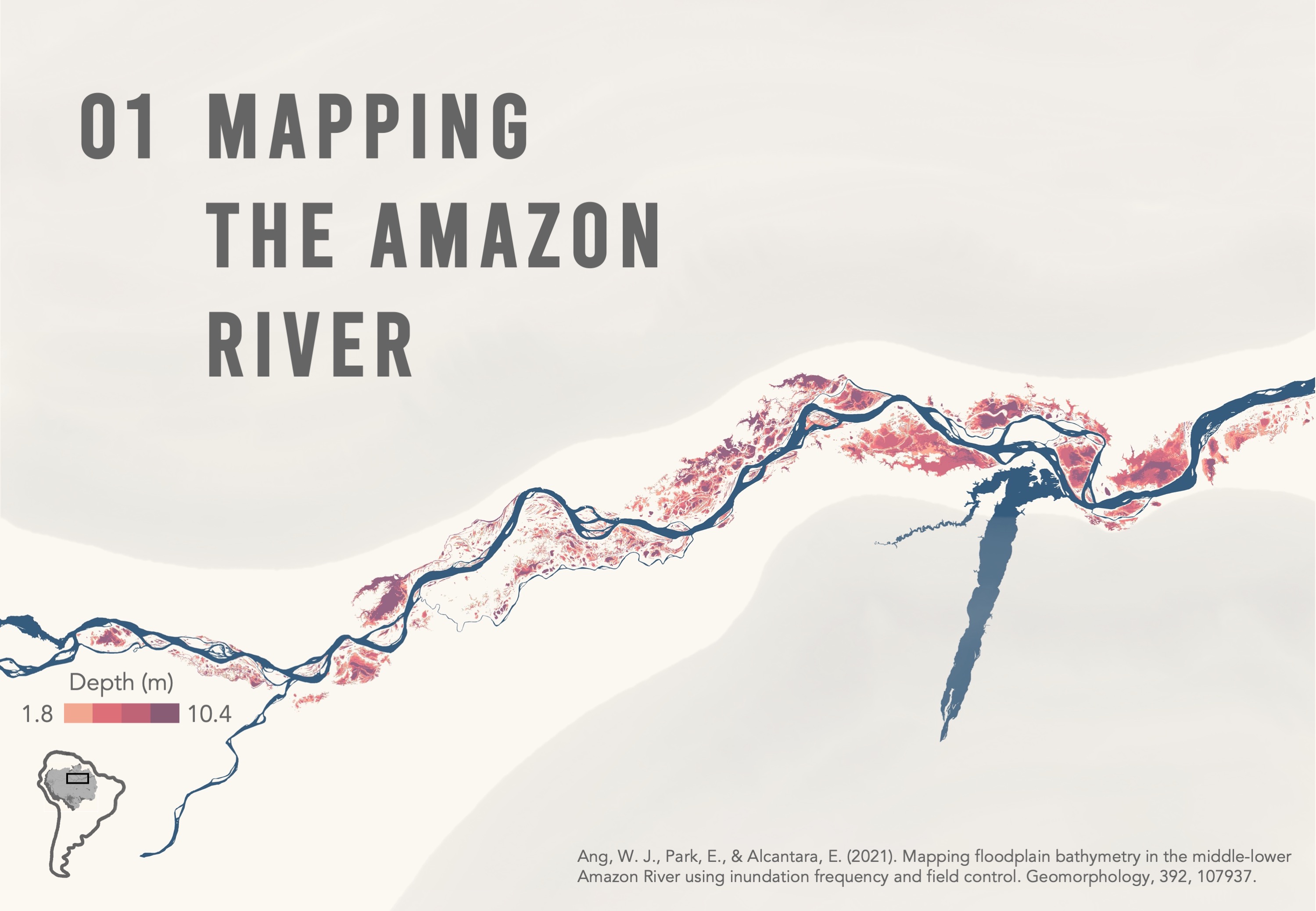
Mapping floodplain depths
The Amazon is the world’s largest river by volume of water. Flowing from the Andes to the Atlantic Ocean, its river basin covers nearly 40% of South America. This paper focuses on the middle-lower reach of the river, where seasonal flooding has formed large floodplain lakes along the riverbanks. The lakes regulate river flow, store nutrient-rich sediments and are home to diverse species.
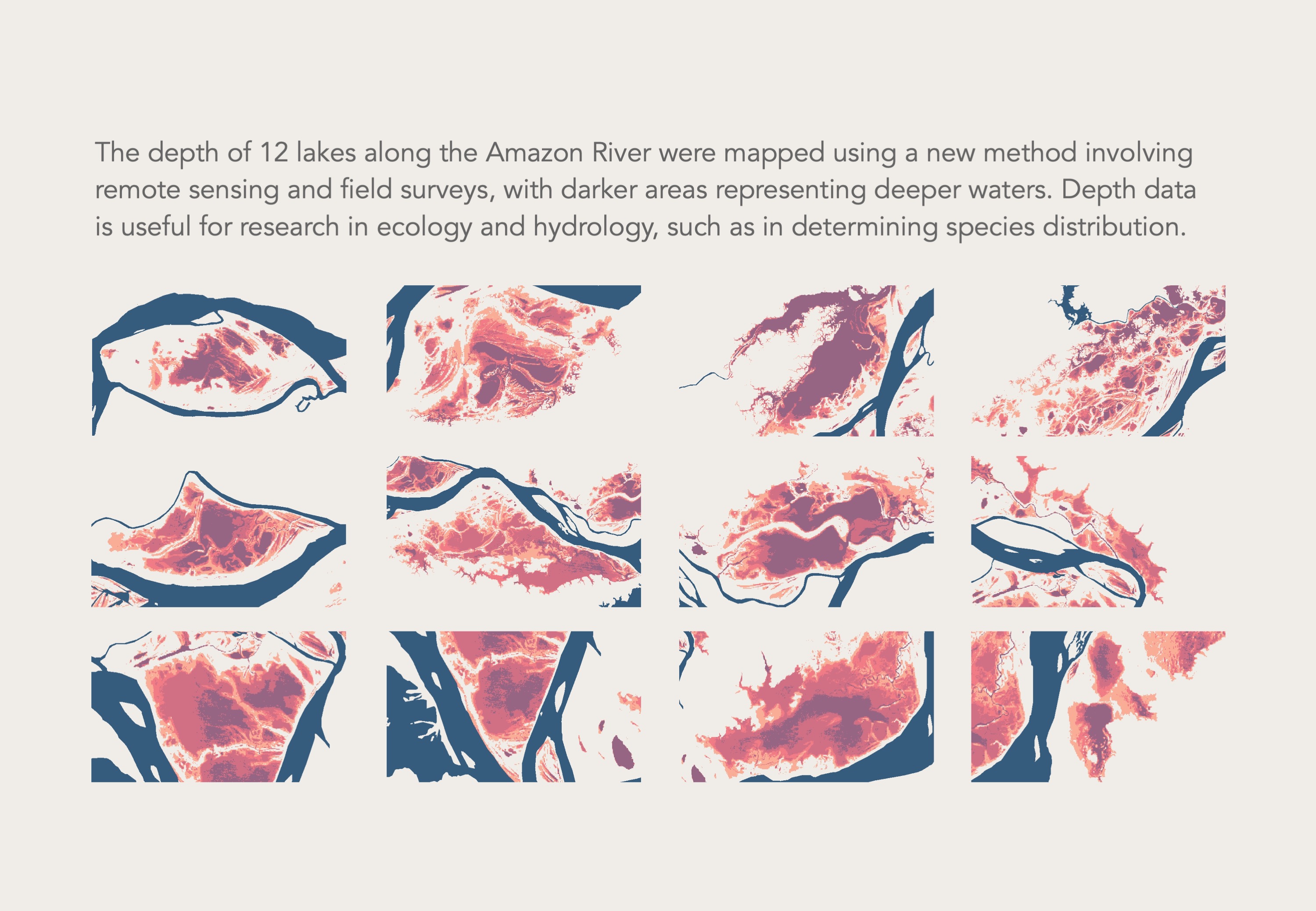
12 floodplain lakes along the middle-lower Amazon were studied, specifically investigating variations in their depths — in other words, their bathymetry. Bathymetry data is useful in different research applications, such as determining sedimentation patterns, or the influence of water seasonality on floodplain biodiversity.
While bathymetry can be measured by boat surveys, this method is usually restricted to a small scale. On a larger scale, remote sensing is adopted, but reliance on light reflectance often results in less accurate measurements of cloudy water bodies like the Amazon lakes.
Considering the limitations of both methods, this paper uses a new method involving inundation frequency (IF), which refers to how often a certain part of a floodplain is flooded. As deeper parts of the floodplain would be flooded more frequently, the relationship between IF and depth can be modelled. Our new method is a versatile approach that could be applied to other rivers with sediment-rich, seasonally-inundated floodplain lakes.
Ang, W. J., Park, E., & Alcantara, E. (2021). Mapping floodplain bathymetry in the middle-lower Amazon River using inundation frequency and field control. Geomorphology, 392, 107937. https://doi.org/10.1016/j.geomorph.2021.107937